David Rumsey Map Center
About us
We are the premiere historical cartographic collection on the West Coast and hold one of the world’s great collections available for public research and global digital access. The collection numbers in the hundreds of thousands of digital and physical objects, with new acquisitions added on a weekly basis.
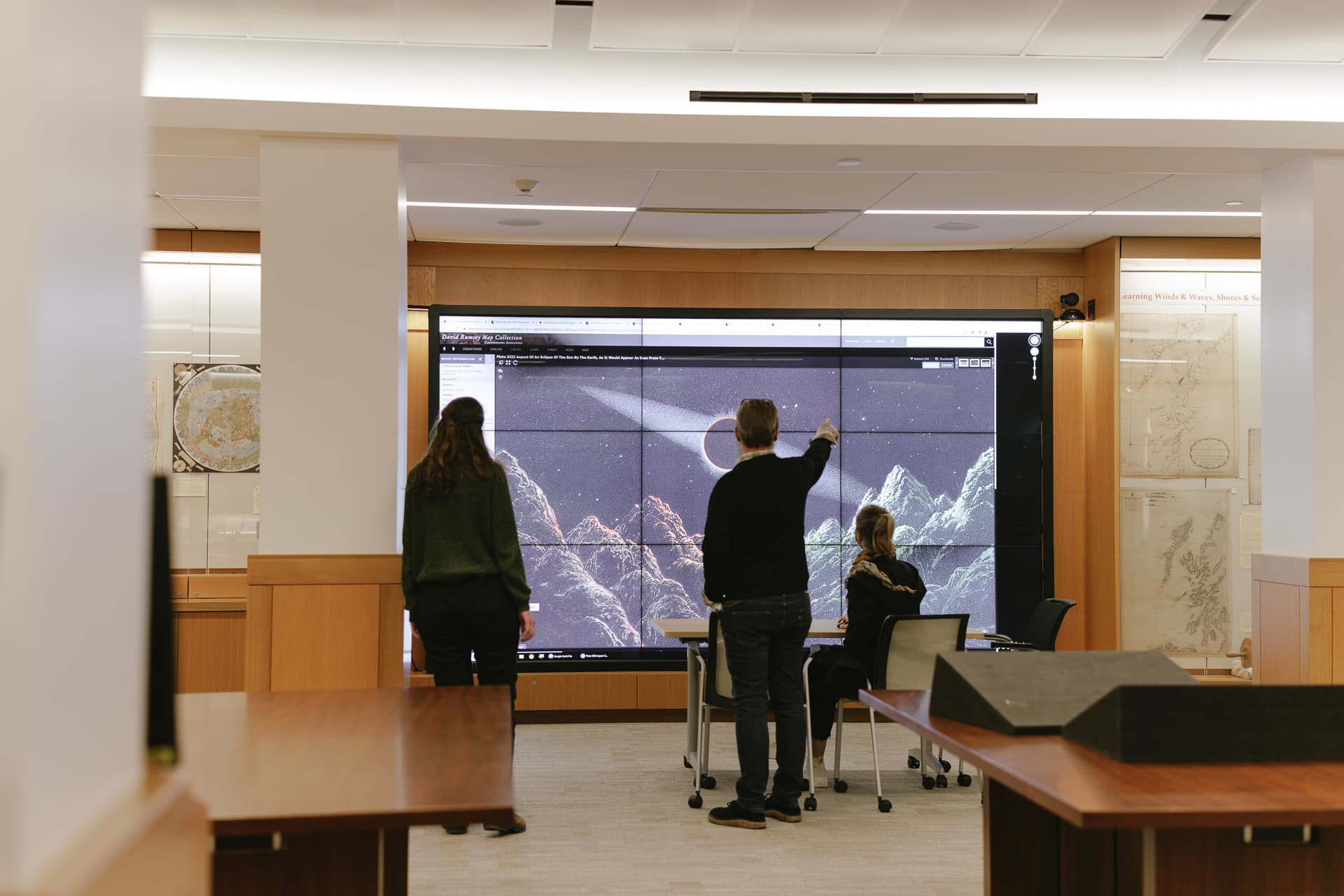
The center is also an exhibition space with a dynamic lineup of shows that feature cartographic materials. Two wall-sized screens are available for viewing maps and metadata in detail. We periodically host conferences, talks, and events. Our map librarians provide consultations and support for researchers, classes, and the public.
Visiting the David Rumsey Map Center
The David Rumsey Map Center is housed inside the Green Library. Entry to Green Library requires either a Stanford ID card or visitor registration with a government-issued photo ID, plus having a photo taken at the registration kiosk. Learn more about Stanford University Libraries’ visitor policies. We are located on the fourth floor, with a stairwell entry just off the Munger Rotunda of the Bing Wing, which is located on the second floor. Ask at the library entry desk about special elevator access if you need step-free entry.
We encourage visitors to drop in during open hours.
Visitors interested in viewing physical items need to request items through SearchWorks and schedule a material viewing appointment. You may view up to five items at a time. Learn more about access to Stanford's rare and distinctive materials.
Because we are home to rare maps, we do not allow food or drinks (including water), and we do not allow any ink writing utensils in the center. Laptop devices are welcome, and pencils and paper are available for note-taking. Photography of materials is permitted for personal use but photography and video recording of library spaces is not. See Stanford University Libraries’ photography policy for more information. Lockers are available for stowing your belongings.
Research support
Featured collections
David Rumsey Collection
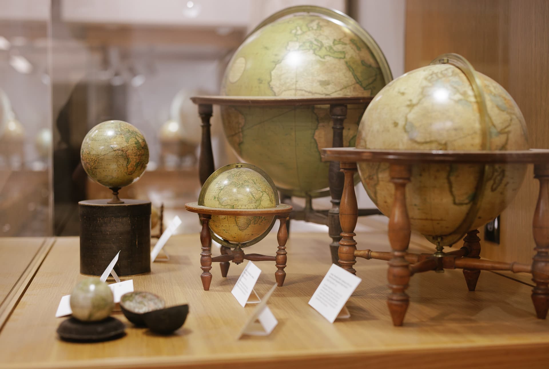
View items in SearchWorksView high-resolution scans that showcase the breadth of the David Rumsey Map Collection, including atlases, globes, school geographics, maritime charts, pocket maps, wall maps, and manuscript maps.
Maps of Africa
Go to the exhibitStanford University Libraries is home to a strong collection of maps of Africa, including maps donated by Oscar I. Norwich and Caroline Batchelor as well as maps from the Barry Lawrence Ruderman Collection, the University of Cape Town Collections, and the David Rumsey Map Collection.
Glen McLaughlin Map Collection of California as an Island
View items in SearchWorksThe first mention of California as an island is in Garci Rodriguez de Montalvo’s novel Las Sergas de Esplandián, published in 1510. It was not until Father Eusebio Kino’s map A Passage by Land to California was published around 200 years later that this cartographic blunder was exposed. Containing nearly 800 maps, materials in this collection range from hemispheric to world maps, from title pages to celestial charts, all depicting California as an island.
Accessibility
Patrons with limited mobility can take the Bing Wing elevator to the fourth floor.